Wednesday, October 30, 2013

Portsmouth Virginia offers great sightseeing, seafood and a view into U.S. naval history

Anchor in front of the Portsmouth Naval Shipyard Museum.

Virtual Cruise of the East Coast: Portsmouth, Virginia

 Re-posted in part from the article written by George Sass Sr. / Published: October 1, 2013 Yachting Magazine. Photos added for story enhancement.

Our next leg takes us 50 miles south to Portsmouth, Virginia, where we plan to stay a couple of days to re-provision, see the sights and visit family in Virginia Beach. The marinas in the area are spread out between Hampton and Newport News on the north side of the Hampton Roads waterways, and Norfolk and Portsmouth on the south. Virginia Beach, southeast of Norfolk, also has a number of marinas accessible from the Atlantic Ocean by navigating the sometimes-tricky Rudee Inlet.

As we make our approach to Portsmouth, we pass Naval Station Norfolk on Sewell’s Point, where we get a glimpse of a couple of aircraft carriers and guided-missile destroyers in port. Naturally, we give this area a wide berth, staying closer to the west side of the deep channel. This impressive facility supports up to 75 ships serving in the Atlantic and Indian oceans as well as the Mediterranean Sea.

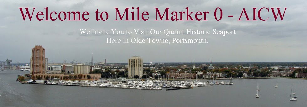
Mile marker "0" AICW is located between Portsmouth and Norfolk, Virginia.  Photo by Allen Graves.

Over the years, we've found the Portsmouth area to be the most accommodating for us when traveling up and down the ICW. It’s close to mile zero of the ICW, and its renovated waterfront provides an attractive expanse of public green space and walking paths. An added bonus is that it’s just across the Elizabeth River from Norfolk’s Nauticus marine museum and science center, the tour-able battleship USS Wisconsin and the Waterside Festival Marketplace. We choose the Tidewater Yacht Marina for its comfortable amenities and convenient location to Portsmouth’s Olde Towne section.

After getting settled in at the marina, we walk to North Landing Park, one of the landings for the ferry to Norfolk’s Waterside. Following the waterfront for a couple of blocks, we come to High Street Park, another ferry landing where we find a number of cruising boats tied to the bulkhead for free. There’s no electricity or water, and while there are signs posted that say overnight docking is not allowed, we’re told that a couple of these snowbirds have been here for a day or two without being hassled by city officials.

On the corner of High and Water streets is the Portsmouth Naval Shipyard Museum. Covering 250 years of maritime history, the museum offers a look back at how America’s oldest and largest naval shipyard came to be so influential during Colonial days, the Civil War and especially recent times. Nearby, the U.S. lightship Portsmouth, built in 1915, is on display. We continue our walk along the city’s Path of History and discover a pavilion displaying the immense Fresnel lens from Hog Island Light, which began its service in 1896. At 10 feet high and weighing 1,500 pounds, it’s one of the largest and brightest lenses of its kind.

Riverfront pavilion displaying the immense Fresnel lens from Hog Island Light. Photo by Joe Elder.

Walking west on High Street toward Olde Towne, we pass the Children’s Museum of Virginia, which we've heard is the perfect place to stop when cruising with kids. Fun train rides and the new Bubble Room are designed to keep the little ones entertained for hours. For us, though, it’s happy hour, so we stop at the recently reopened Gosport Tavern on High Street for an early dinner of good old-fashioned fish ’n’ chips.

The Gosport Tavern located at 702 High Street, Olde Towne Portsmouth, VA  Photo by Joe Elder.

Here is a link to the complete article online from Yachting Magazine website.

Saturday, May 4, 2013

Olde Towne Antiques to Flea Market

The popular "Antiques to Flea Market’ is held the first Saturday of each month, in Olde Towne Portsmouth. Browse through an eclectic collection of unique and antique wares. With over 60 dealers and vendors exhibiting, bargain hunters and serious collectors will discover a great selection of antique and estate furniture, architectural antiques, china, silverware, art and prints, sporting gear, musical instruments, books and ephemera. There are even hand-made crafts and toys, as well as decorative accessories and flea market items of all types and one-of-a-kind items priced to sell. Held inside the Middle Street garage located on the corner of Middle and London.

The Olde Towne Antiques to Flea Market is held
the first Saturday of each month in Portsmouth, Virginia
The Olde Towne Antiques to Flea Market opens at 10 am til 2 pm. Come early for best selections! http://www.oldetowneportsmouth.com/ or call 757-339-1876. Sponsored by the Olde Towne Business Association. 

Wednesday, March 20, 2013

4th Annual Elizabeth River Nautical Yard Sale & Flea Market


4th Annual Elizabeth River
 Nautical
Yard Sale & Flea Market
Saturday, May 18, 2013
9am to 5pm

Ocean Marine Parking Lot on Wavy Street in Portsmouth
Individual Vendor Space: $10.00
Bring your own tables or tents.

Call (757)321-7432 for more information and to reserve your space!

Friday, February 22, 2013

Anchor Alarm Surprises and GPS

Notice that the point where the anchor position is set in the alarm is the position of the GPS and not the position of the bow/anchor.

Written by Karen Siegel
aCappella
Castine, Maine

It should be simple. Pick the spot to anchor; come to a stop; drop the anchor and set the anchor alarm. Then pull back until the anchor sets. Now if you pull away further from the anchor set point than the distance


you specified, alarms should go off, right?
Well, not exactly. The mathematics are surprisingly a lot more complex. We know. It seems easy and obvious. We've been involved in many debates until the pencil and paper come out and then, "oh yeah" is heard.

Here's the missing magical point. You've got to notice that the point where the anchor position is set in the alarm is the position of the GPS and not the position of the bow/anchor. That one small point ends up
bringing a whole bunch of trigonometry into the calculation. When the boat swings 180 degrees, the error created by that offset equals twice the distance from the bow to the GPS.

Let's take an example for a typical 42' sailboat with a GPS on the stern rail. This is the worst case problem but is very typical and demonstrates what happens very well.

So we're anchoring in 10' of water with a bow that's 5' off the water's surface. A good scope for a night without much weather expected would be 5:1. This means 75' of rode will be let out and pulled back to set hard (we call that power setting). The anchor alarm is set at 125', way more than the 75 put out. And since we power set the anchor, we couldn't possibly move 50', right?

At 3 am, because these things always happen at 3 am, the anchor alarm goes off. You're 127' back. You remember that you way over added to the 75' and start planning what you're going to do in the total black of night with the moderate wind that's now blowing.

What really happened is that the tide changed at 1 am. During the next 2 hours you slowly swung around moving back. Not realizing this new math for anchor alarms you didn't realize that the GPS displacement caused 84' of position error in the anchor alarm. Your alarm went off after moving back only 52'. In reality, your anchor alarm should watch you move back another 32' without your anchor moving 1 inch on the sea floor. The anchor alarm should have probably been set at about 75 + 84 + 10 + 10 = 179 feet. The two 10's are for GPS accuracy error and slop since the anchor doesn't set immediately. Can you imagine setting an anchor alarm at almost 200' with only 75' of rode out? And yet, that's the right number.

We haven't found an anchor alarm that compensates for this GPS positional error. It's one of the reasons we wrote DragQueen (available for free in the Apple app store and Google Play). Since the anchor alarm is on a phone, the GPS position is the phone itself. When deploying the anchor, we stand with the iPhone at the bow to eliminate one half the GPS position error. There's still another position error based on where the GPS is located while we sleep at night (25' back in our stateroom).

Remember too that this positional error happens at all angles. Swing about 90 degrees to the side and the error is about 1 times the GPS displacement distance. Even that can be significant.

Given a heading/fluxgate sensor and a few configuration settings, 100% of this GPS positional error could be eliminated. How come not a single marine electronics manufacturer has done it?

If you're still saying, "wait a second - there's not a 2x error in the position" - check out this graphic proof of what happens. We'll wait to hear the "oh yeah":

Happy anchoring!